A developer recently brought us to a hillside lot near the San Luis Rey River in Oceanside, where winter rains had already carved gullies deep enough to expose utility lines. That project needed a soil erosion analysis to quantify sediment yield and design proper drainage before any foundation work could proceed. Without that study, the site would have lost another three inches of topsoil in the next storm season, delaying the entire schedule. We combine field reconnaissance with lab testing, including the granulometry of surface layers, to predict erosion rates under local rainfall intensities that routinely exceed 0.5 inches per hour. The goal is always the same: give the contractor a defensible number for cut-and-fill volumes and a clear plan for sediment control.
Without a site-specific soil erosion analysis, Oceanside hillside projects risk losing 3 to 5 inches of topsoil per decade under current rainfall patterns.
Method and coverage
- Rainfall erosivity (R-factor) from NOAA data for San Diego County
- Soil erodibility (K-factor) via texture and organic matter content
- Slope length and steepness (LS-factor) from on-site survey
- Cover management (C-factor) based on vegetation type
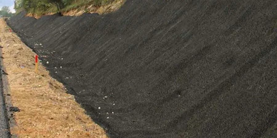
Regional considerations
Oceanside has more than 175,000 residents and roughly 15 miles of coastline, but the real erosion risk is inland along the San Luis Rey River corridor and the steep slopes of the Santa Margarita Mountains. In 2023, winter storms dropped over 14 inches of rain in three months, triggering multiple slope failures on undeveloped lots. A soil erosion analysis catches these problems early: it identifies areas where the annual soil loss exceeds 10 tons per hectare, which is the threshold where local building departments require a Sediment Erosion Control Plan (SECP). Skipping this step means remediation costs can jump fivefold once exposed slopes start undercutting foundations.
Standards that apply
ASTM D4972 — Standard Test Methods for pH of Soils (dispersion indicator), ASTM D422 — Particle-Size Analysis (texture for K-factor), RUSLE2 — Revised Universal Soil Loss Equation (NRCS methodology), California Building Code Chapter 70 — Grading and Erosion Control
Complementary services
Field Erosion Risk Assessment
On-site walkover with GPS mapping of rills, gullies, and concentrated flow paths. We classify erosion severity using the USDA-NRCS visual indicators and mark priority areas for treatment.
Laboratory Soil Dispersion Testing
Double hydrometer and pinhole tests per ASTM D4647 to identify dispersive clays that can cause tunneling erosion even on gentle slopes. Critical for the clay-rich horizons found near the San Luis Rey floodplain.
RUSLE2 Modeling for Permit Support
We run the NRCS RUSLE2 model with Oceanside-specific rainfall data, soil survey polygons, and proposed grading plans to produce defensible annual soil loss estimates for city review.
Typical parameters
Top questions
How much does a soil erosion analysis cost in Oceanside?
For a standard residential lot up to 1 acre, the total cost ranges between US$790 and US$2,270, depending on the number of field visits, lab tests required, and whether you need full RUSLE2 modeling for a grading permit. We provide a fixed-price quote after reviewing the site location and proposed earthwork volumes.
What is the difference between a soil erosion analysis and a slope stability study?
A soil erosion analysis focuses on surface soil loss from runoff and rainfall impact, while a slope stability study evaluates deep-seated failure mechanisms like rotational slides or translational slips. In Oceanside, we often recommend both for hillside parcels because the same storm event can trigger surface rilling and a deeper landslide. The erosion analysis feeds into the sediment control plan, whereas the stability study checks factor of safety against mass movement.
When should I schedule a soil erosion analysis during my project timeline?
Ideally before any grading or vegetation removal, because the pre-construction condition sets the baseline for allowable soil loss. If you have a steep Oceanside lot, order the analysis at least 60 days before submitting your grading permit. That gives us time to run the lab tests and model the RUSLE2 output, plus a buffer for coordinating with the city engineer if the numbers exceed the tolerance limits.